Tuesday, October 19, 2010

Lab 3: Neogeography

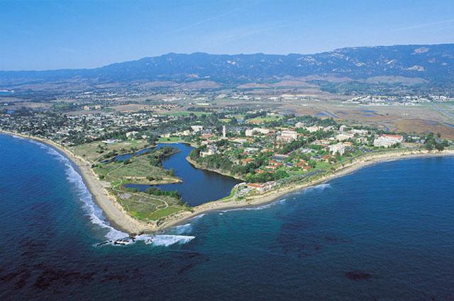
Turner (2006) defined neogeography as “…people using and creating their own maps, on their own terms and by combining elements of an existing tool set." Here I have created a map that draws from my own interests and shared it with others. When I was in high school, my friends and I liked going to the beach because I am from Santa Barbara. This was especially the case in the summer time, but since the weather was relatively constant year round, going to the beach was not uncommon. Whether we went to the beach to play football, volleyball, Frisbee, to skim board, surf, boogie board, or just to go and hang out, we would always get hungry when we were leaving. Since we liked to keep things cheap, we would go to a fast food restaurant to curb our appetite. Burgers were always a favorite. Nothing like greasy American food to fill you up after the being at the beach. My personal favorite was and is Jack in the Box. This is because Jack in the Box has so many chicken options. Many argue otherwise, but I do not eat beef or pork so my loyalty to fast food burger places lies with Jack in the Box. Since then, I have preferred a little higher quality burger places like Fatburger, but I always stop by Jack in the Box every now and then.

Commentary:
I would like to take a moment to point out the pros and cons of my map. Although it is an interesting way for the University of California campus community to view the different routes to the various beaches, there are some factors one should consider. The locations for the starting points were chosen arbitrarily (wherever Google had the name of the campus displayed, was where the starting point was made). Also the the beaches that were chosen as ending points were chosen by personal preference and do not reflect the only route that could be taken to get to a beach. 

These are the pitfalls of neogeography. Since this map is made using my terms, my experience, and my preference, it mostly applies to me before it can apply to the average student. There is a lot of potential as well to neogeographic maps. It can serve as a comparison to how we interpret the world around us in relation to another person.The purpose of my map is to provide a brief map of optional routes to take when considering going to the beach and grabbing a bite to eat along the way. It was tradition for me and my friends so I hope I can pass the knowledge on. Some things that I would have done differently if I were to do this again would be, to survey students on each UC campus where their favorite beach and fast food place was and map out those routes and locations. Unfortunately I do not have the time or resources to accomplish this task. Fortunately Google is available to everyone with an Internet connection, so hopefully people will be able to use this as a reference in making their own decision on planning their beach trip. 


Follow the link to view my map and videos about the various beaches!

Sunday, October 10, 2010

Lab 2: Analyzing the 7.5 Minute Map

1. What is the name of the quadrangle?
This quadrangle is called the BEVERLY HILLS QUADRANGLE, CALIFORNIA-LOS ANGELES CO. 7.5 MINUTE SERIES (TOPOGRAPHIC)


2. What are the names of the adjacent quadrangles?
The names of the adjacent quadrangles are Canoga Park, Van Nuys, Burbank, Topanga, Hollywood, Venice, and Inglewood.


3. When was the quadrangle first created?
This quadrangle was compiled in 1966, the imagery in 1978, and inspected in 1995.


4. What datum was used to create your map?
The National Geodetic Vertical Datum of 1929 was used to create this map. There are also datum from the North American Datum of 1927 and 1983.


5. What is the scale of the map?
The Scale of this map is 1:24,000


6. At the above scale, answer the following:
a) 5 centimeters on the map is equivalent to how many meters on the ground?
[(5centimeters on map)x(24000centimeters on ground)]/[100meters on ground] = 1200 meters on ground


b) 5 inches on the map is equivalent to how many miles on the ground?
[(5 inches on the map)x(24000 inches on the ground)]/[(12 inches per foot) (5280 feet in a mile)] = 1.8939 miles


c) one mile on the ground is equivalent to how many inches on the map?
[1 mile on the ground]/[(24000 miles on map)(5280 feet per mile)(2.54 inches per foot)] = 3.319 x 10^8


d) three kilometers on the ground is equivalent to how many centimeters on the map?
[(3km on the ground)/(3x24000 km on the map)(1000 meters in a km)(100 cm in 1 meter)] = 4.166 x 10^-10 centimeters on the map


7. What is the contour interval on your map?
The contour interval of this map is 20 feet.


8. What are the approximate geographic coordinates in both degrees/minutes/seconds and decimal degrees of:
a) the Public Affairs Building;
http://www.spa.ucla.edu/media/news_images/NewBldgNameWeb07.jpg


[34° 4' 1.5258", -118° 26' 50.8726"] or [34.067°, -118.447°]
b) the tip of Santa Monica pier;


http://home.comcast.net/~bygonebyways/66CA-Santa_Monica-Pier_Bench.jpg
[34° 0' 26.7978", -118° 29' 59.6394"] or [34.007°, -118.499°]


c) the Upper Franklin Canyon Reservoir;


http://www.lamountains.com/enlarged_images/franklin1_enlrg.jpg
[34° 7' 12.5538", -118° 24' 37.08"] or [34.120°, -118.410°]


9. What is the approximate elevation in both feet and meters of:
a) Greystone Mansion (in Greystone Park);
580 feet, 176.78 meters
    690ft, 210.312m


http://www.diglounge.net/wp-content/uploads/2008/06/greystone.jpg
[34° 5' 31.8156", -118° 24' 5.0394"] or [34.092°, -118.401°]


b) Woodlawn Cemetery;
140 feet, 42.672 meters
http://www.thewoodlawncemetery.org/film.html
[34° 1' 5.963", -118° 28' 41.959"] or [34.018°, -118.478°]


c) Crestwood Hills Park;
690 feet, 210.312 meters
http://www.travelinlocal.com/wp-content/uploads/2009/10/tl10-10.jpg
[34° 4' 38.5644", -118° 29' 17.34"] or [34.077°, -118.488°]


10. What is the UTM zone of the map?
The UTM zone of the map is Zone 11.


11. What are the UTM coordinates for the lower left corner of your map?
3763000N and 3615000E


12. How many square meters are contained within each cell (square) of the UTM gridlines?
1,000,000 sq meters


13. Obtain elevation measurements, from west to east along the UTM northing 3771000, where the eastings of the
UTM grid intersect the northing. Create an elevation profile using these measurements in Excel (hint: create a line
chart). Figure out how to label the elevation values to the two measurements on campus. Insert your elevation
profile


Points 5 and 6 represent 500 and 460 respectively (the points that encompass the UCLA campus)


14. What is the magnetic declination of the map?
The magnetic declination of the map is 14 degrees East.


15. In which direction does water flow in the intermittent stream between the 405 freeway and Stone Canyon
Reservoir?
The water flows from the north to south in the intermittent stream between the 405 freeway and the Stone Canyon Reservoir.


16. Crop out (i.e., cut and paste) UCLA from the map and include it as a graphic on your blog.